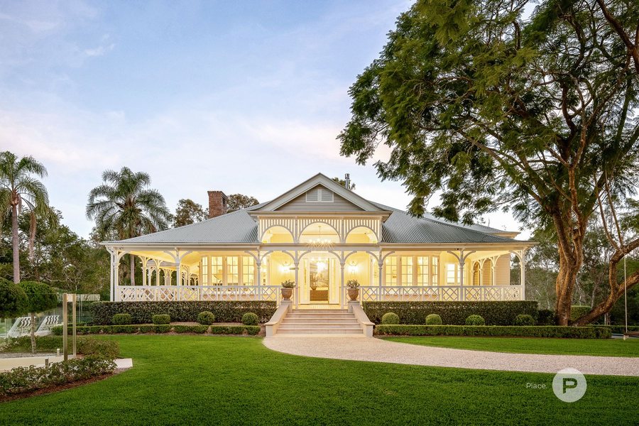
A white Queenslander with wide verandahs on a Pullenvale acreage lawn at dusk

Buyers agent
in Pullenvale

Acreage on the western edge: a hectare of land, bush and creek flats, fifteen kilometres from the CBD.

5.0 ★★★★★

from 219 Google reviews

$2.33m

median house price, November 2026

About 1 ha

typical block

93%

owner-occupied

Our area guide to Pullenvale for families buying a home: the pockets, the schools and their catchments, daily life, getting around, the houses and what to check before you buy.

Our purchases

A home Hunter Gather bought for a client in Pullenvale

An example of what we have bought for clients here

Pullenvale, 2026

$2,560,000

4 bed, 2 bath, 6 car

David Thomas, Chantel Testa

See all our purchases

Pullenvale on the map

Pullenvale is acreage on Brisbane's western edge: about 15 kilometres west of the CBD in a straight line, 19.3 square kilometres of rolling hills, creek flats and bushland in the southern foothills of Mount Elphinstone, which rises to 211 metres in the north of the suburb. Moggill Road clips the eastern side near the Marketplace and Grandview Road runs west through the middle past the state school, the old school site and the hall. About three in four homes sit in Council's rural residential zone, most on lots of around a hectare, and much of the north and west is bushland zoned for environmental management. It is a suburb of family homes on land: about 1,060 houses, almost no units, and more than nine in ten homes owner-occupied.

The numbered markers are the pockets.

Size

14.9 km from the CBD, 19.3 km² in area

Boundaries

Brookfield and Upper Brookfield sit to the north and north-east, Pinjarra Hills to the south-east toward Moggill Road and Kenmore, and Anstead along the long southern and western side, with a short boundary to Kholo in the far west. The longest shared boundary is with Anstead, at about 8.4 kilometres.

Main roads

Moggill Road (the eastern edge, the 444 bus, the run to Kenmore and Indooroopilly). Grandview Road (the spine west past the school, the education centre and the hall). Pullenvale Road (north-east from Moggill Road toward Brookfield, past the forest park). O'Brien Road (the south-west, the pony club and the creek flats).

Neighbours

Brookfield, Upper Brookfield, Anstead, Pinjarra Hills, Kholo

The pockets

1Lisk Street, Herron Road and the eastern ridgeSuits Buyers after a newer home with a view and the shortest run to Kenmore.

Lisk Street, Herron Road, Woodfield Road, Creekwood Place, Dahmac Place and Clover Court

The higher ground on the Brookfield and Kenmore side, where most of the suburb's recent big sales sit: homes on about a hectare, some with views to the city and Mount Coot-tha. Lots here run from about one to one and a half hectares. This is the corner of Pullenvale in the Kenmore State School catchment: all of Lisk Street and most of Herron Road and Woodfield Road go to Kenmore, so check the address before you assume Pullenvale State School.

2Grandview Road and the schoolSuits Families who want to walk or ride to Pullenvale State School and the hall.

Grandview Road, Airlie Road, Osna Place, Fisher Place, Olivia Place, Leila Place and Triandra Place

The middle of the suburb. Pullenvale State School is at 120 Grandview Road, the environmental education centre on the old school site at 250, and the hall at 302. Blocks vary more here than anywhere else, from about 4,000 square metres in the cul-de-sacs off Grandview Road to one and a half hectares and more on the main road. Airlie Road and the low parts of Grandview Road follow Pullen Pullen Creek: check the flood maps on those lots.

3O'Brien Road, Lancing Street and the pony clubSuits Horse families and buyers who want flat, usable land.

O'Brien Road, Lancing Street, Primley Street, Woodward Place, Summerland Place, Avis Place, Revell Street and Boyle Road

The south-west, around Moggill Pony Club at 41 O'Brien Road. Lots are mostly about a hectare, and this pocket has the least bushfire overlay in the suburb. The trade is the creek: Lancing Street, Boyle Road, O'Brien Road and Summerland Place all have addresses inside Council's creek flood planning area or the 2022 flood extent, so read the FloodWise report for the lot, not the street.

4The Marketplace endSuits Buyers who want acreage feel on a smaller block, close to the shops and the bus.

McCaskill Road, Bainbridge Drive, Brimblecombe Circuit, Huntingdale Street, Else Avenue, Doyle Place and Logan Place

The eastern streets between Moggill Road and Pullenvale Road, closest to Pullenvale Marketplace on McCaskill Road and the 444 bus on Moggill Road. The blocks are smaller: about half a hectare is typical, from about 4,000 square metres to a hectare. All of these streets fall to Pullenvale State School.

5Haven Road, the cedar roads and the bushSuits Buyers who want the most land and the most privacy, and accept the bushfire work that comes with it.

Haven Road, Red Cedar Road, White Cedar Road, Lilly Pilly Road, Crow's Ash Road, Kamala Drive, Old Farm Road and Mill Road

The north and west, below Mount Elphinstone, with the biggest lots in the suburb: a typical lot is about one and a half hectares and one in four is four hectares or more. Close to half of the homes here sit in the bushfire overlay, and much of the surrounding land is zoned for environmental management. Mill Road ends at a gate into Moggill Conservation Park, and the heritage-listed Pullenvale Cemetery is off Haven Road. A small extractive industry zone sits at the far north-west corner beyond Mill Road.

Schools and catchments

Pullenvale has its own state primary school, and every home in the suburb is in the catchment for Kenmore State High School. For primary school the suburb splits about six to one: Pullenvale State School on Grandview Road takes most of it, and Kenmore State School takes the eastern corner around Lisk Street, Herron Road, Woodfield Road and part of Pullenvale Road. Both state schools and Kenmore State High run enrolment management plans. Brisbane Independent School, a small independent primary, is on Moggill Road inside the suburb, and Pullenvale Environmental Education Centre on Grandview Road runs programs for visiting school groups rather than taking enrolments.

Primary catchment, most of the suburb
PullenvaleState school, enrolment capped at 426
Secondary catchment
Kenmore SHSEnrolment capped at 2,231
Catchments touching the suburb
2 primary, 1 secondaryDrawn street by street. Check the lot on EdMap.

Prep to 6, Cap 426. Most of the suburb, about 86% of homes

Pullenvale State School

Prep to Year 6 at 120 Grandview Road, the primary school for about six in seven Pullenvale homes. Opened in 1874 and rebuilt on Grandview Road in 1981. Its enrolment management plan was gazetted on 30 January 2026 with a cap of 426 students, so in-catchment families come first.

120 Grandview Road, Pullenvale QLD 4069

Kenmore State SchoolPrep to 6, Cap 491. The eastern corner, about 14% of homesPrep to Year 6 in Kenmore, the primary school for the eastern corner of Pullenvale around Lisk Street, Herron Road and Woodfield Road, about one home in seven. Enrolment management plan gazetted on 6 March 2026 with a cap of 491 students.

Three primary catchments and one secondary catchment touch Pullenvale. Checked against the Department of Education's 2026 catchment polygons (data current 22 July 2026) on 20 November 2026, by share of address points: Pullenvale State School 86 per cent, Kenmore State School 14 per cent and Brookfield State School four addresses; Kenmore State High School 100 per cent. Pullenvale Road and Herron Road are split between Pullenvale and Kenmore State Schools.

Daily life in Pullenvale

The places the week runs on. Pullenvale has one small shopping centre; the big shop, most of the cafes and the evening out are a drive away in Kenmore or Indooroopilly.

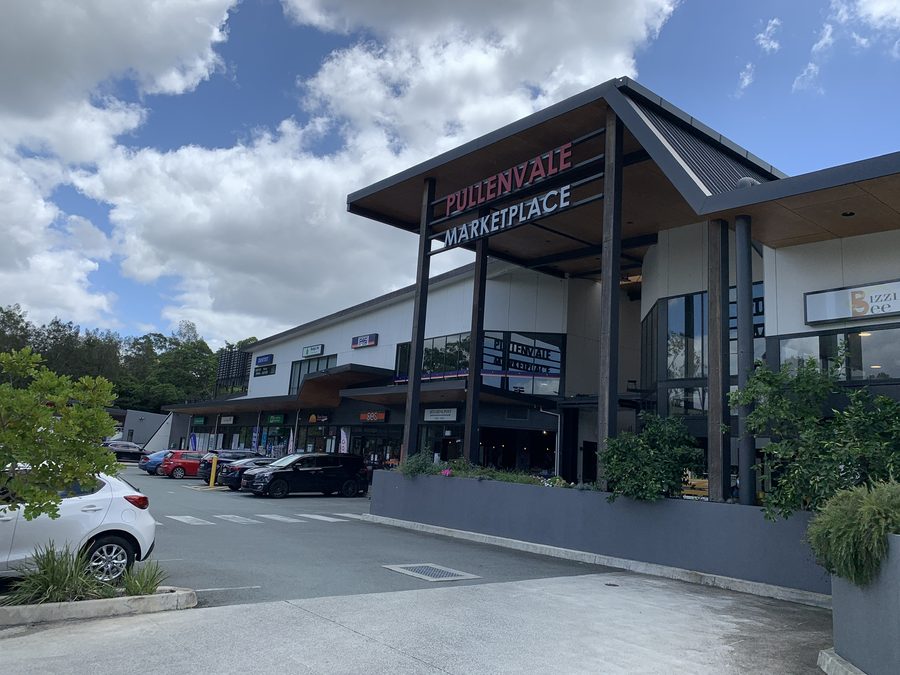
Pullenvale Marketplace

Pullenvale Marketplace

The suburb's own shopping centre on McCaskill Road, just off Moggill Road, anchored by an IGA supermarket, with a pharmacy and a GP upstairs. The milk, bread and script run without leaving the suburb.

8 McCaskill Road, Pullenvale QLD 4069

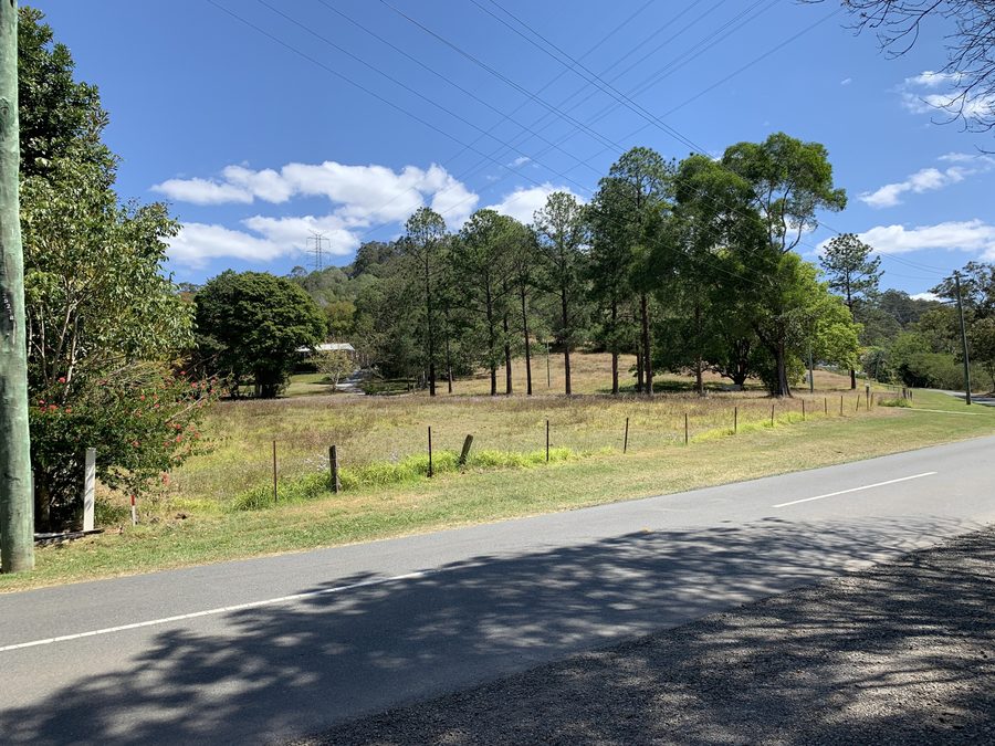
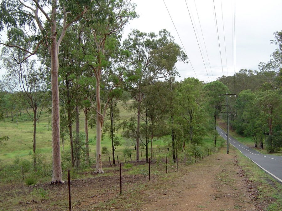
A fenced paddock and tall gums beside a country road at Upper Brookfield
Gum trees along a fenced paddock beside a road at Pinjarra Hills
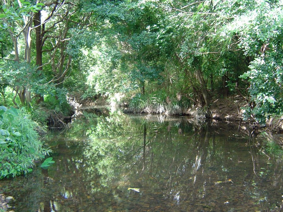
Moggill Creek running still under thick trees at Brookfield

Acreage country around Pullenvale: paddocks and gums at Upper Brookfield and Pinjarra Hills, and Moggill Creek at Brookfield.

Getting around

To the CBD
15 kmIn a straight line from the middle of the suburb
Typical block
About 1 haMedian freehold lot, Queensland cadastre
Bus
Route 444On Moggill Road at the eastern edge

Train

No train line in Pullenvale or anywhere on this side of the western suburbs. Families who commute by train drive or ride the bus to Indooroopilly, about nine kilometres east in a straight line. Check the Translink journey planner from your street.

Bus

Route 444 runs along Moggill Road on the eastern edge of the suburb toward Indooroopilly and the city, with a stop on Moggill Road at Grandview Road. Most of Pullenvale is a drive or a long walk from that stop: from the education centre on Grandview Road it is about two kilometres. Check the timetable for your stop and time of day.

Road

Almost everyone drives. Grandview Road and Pullenvale Road both meet Moggill Road, and Moggill Road runs east through Kenmore to Indooroopilly and the city, with the Centenary Motorway and Legacy Way as the routes across to the south and north. The 2021 Census counted about 850 residents driving to work and about 50 taking public transport, with more than 600 working from home.

Bus routes

Routes 444.

Route named in the bus note above. Timetable on Translink.

Pinch points

Every trip out of Pullenvale toward the city starts on Moggill Road, so the morning traffic through Kenmore sets the commute. Drive it at 7.30am on a school day before you buy.

Weekends

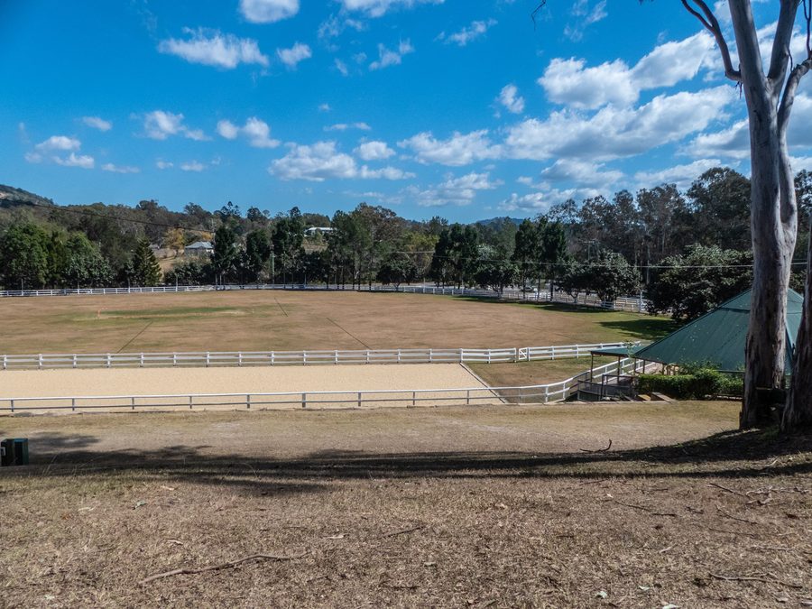
Brookfield Show, Pullenvale

Brookfield Show

The local agricultural show at Brookfield Showground, 550 Brookfield Road, over three days in May.

Gold Creek Reservoir, Pullenvale

Gold Creek Reservoir

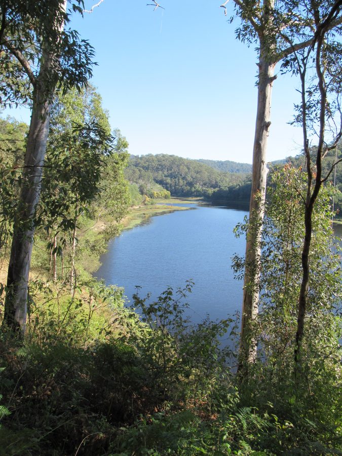
At the end of Gold Creek Road past the Brookfield Showground: a walking track around the reservoir of about four and a half kilometres, a day use area with picnic tables and toilets, and no swimming, boating or fishing.

Pullenvale Forest ParkCouncil bushland on Pullenvale Road with a picnic area, where a Bushcare group is restoring the creek habitat along Pullen Pullen Creek. The education centre walks its school groups here.

386 Pullenvale Road, Pullenvale QLD 4069

Moggill Conservation ParkState-managed bushland on the Pullenvale and Anstead edge, with walking, cycling and horse riding on the management roads. Enter at the Mill Road gate in Pullenvale or the Chalcot Road car park in Anstead. No camping.
Moggill Pony ClubDespite the name, on its own four hectares at 41 O'Brien Road in Pullenvale since 1967. Rallies on the fourth Sunday of the month except December and January, open to riders of all ages.

41 O'Brien Road, Pullenvale QLD 4069

Gold Creek Reservoir seen between tall gum trees
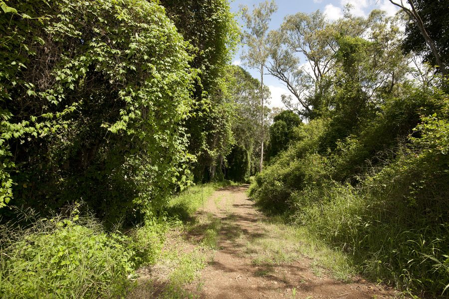
A dirt bush track through dense green bushland
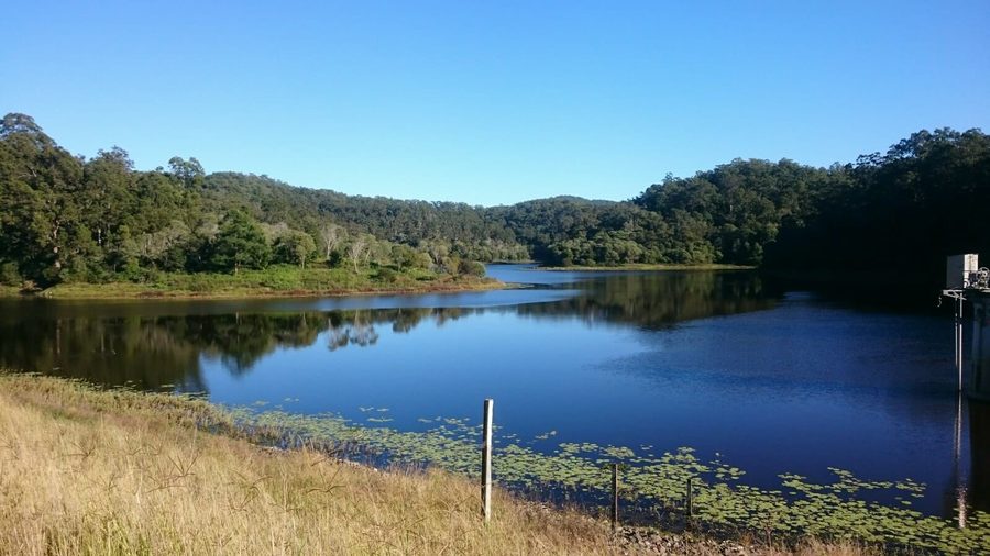
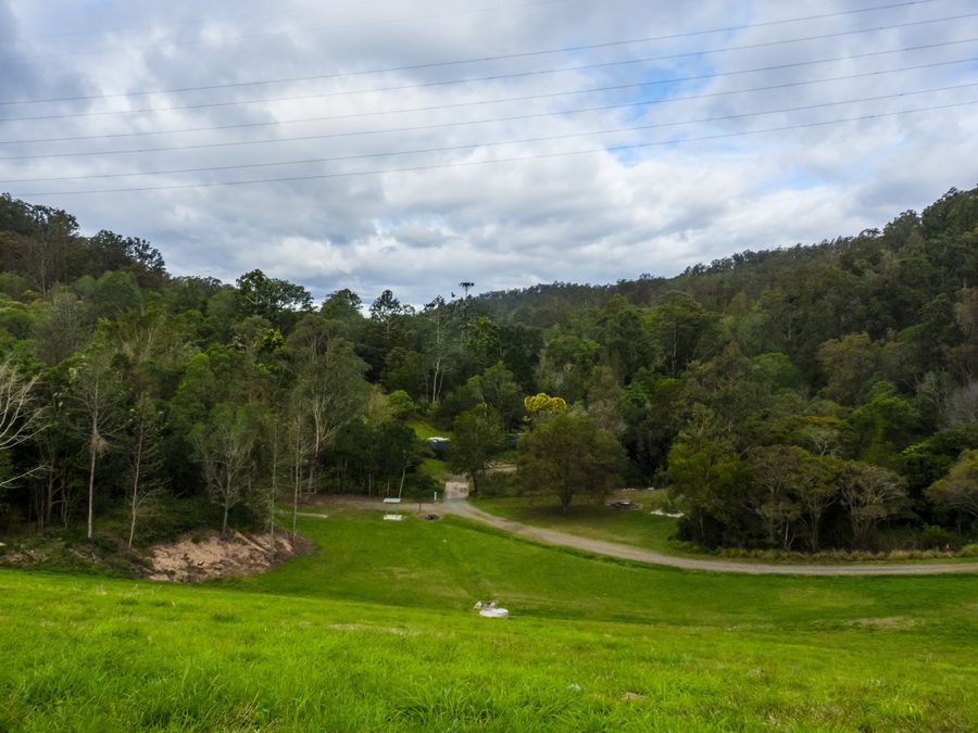
The grassed dam wall at Gold Creek Reservoir below forested hills

Gold Creek Reservoir at Brookfield, and a bush track in Anstead Bushland Reserve on the Pullenvale boundary.

The houses

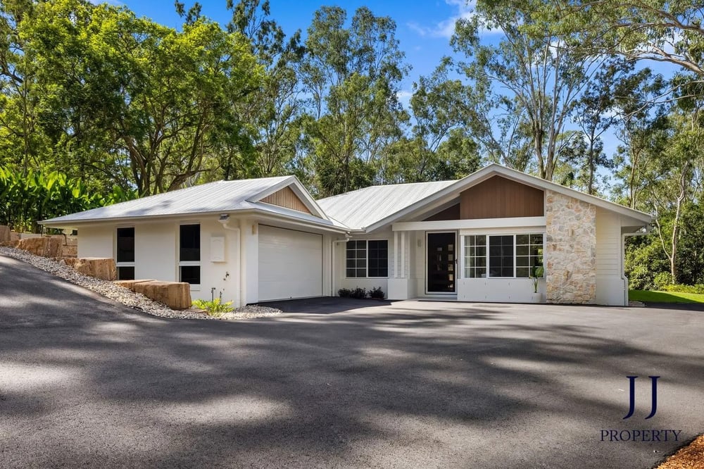
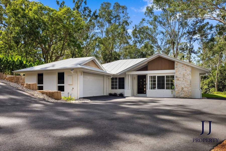
A new single-level acreage home with a long driveway, surrounded by gum trees
A new acreage home among the gums

What is here

Family homes on land. Most are brick, rendered or timber houses from the 1970s to the 2000s on about a hectare, many with a pool, a big shed and space for horses, and newer architect and project homes have been built on the eastern ridge since about 2020. A few character homes are scattered through the suburb, including Queenslanders relocated onto acreage. The 2021 Census counted about 1,060 houses and only a handful of units, and more than nine in ten homes are owner-occupied.

Block sizes

Big. Of about 1,100 freehold lots read from the Queensland cadastre on 20 November 2026, the median is about 10,100 square metres, and the middle half runs from about 9,500 to 14,000. More than half are between one and two hectares. The smaller lots, about half a hectare, are around the Marketplace end, and the biggest, often four hectares and more, are in the north and west below Mount Elphinstone. On acreage check how much of the land is usable: slope, bushland that cannot be cleared and the creek can all take a large share.

Character overlays

Pullenvale has no traditional building character or dwelling house character overlay. What shapes what you can build here is the zoning: about three in four homes are in the rural residential zone and most of the rest are in environmental management, rural or conservation zones, with bushfire, flood, waterway and vegetation overlays on many lots.

What the money buys

Under $2m
An older or smaller acreage home: a 1970s to 2000s four-bedroom house on a quarter of a hectare to a hectare, or an original home on a big bush block that needs work. Recent sales here include a three-bedroom 1970 home on 1.7 hectares at $1,575,000 and four-bedroom homes on 2,500 square metres to 1.2 hectares at about $1.9m.
$2m to $3m
The middle of the market: a family home from the 1990s or later with a pool and a shed on about a hectare. One of our purchases here in 2026, a new four-bedroom home with a pool and a large shed on about a hectare, settled at $2,560,000.
$3m to $4m
A renovated or relocated character Queenslander with a pool, and sometimes stables, on a flat, usable hectare. Two sold in 2026 at $3,225,000 and $3,750,000.
$4m and over
A newer prestige home with city views on the eastern ridge around Lisk Street and Herron Road. Two homes there sold in 2025 at $4,350,000 and $4,500,000.

How it was built

  1. 1827

    Allan Cunningham names the peak in the north of the suburb Mount Halsey; it is now Mount Elphinstone.

  2. 1873

    Pullenvale is described as a new name, replacing Glen Pullen, and ten acres are reserved for a cemetery off what is now Haven Road.

  3. 1874

    Pullenvale State School opens on 16 March with 32 students, after residents raise the money for the building.

  4. 1943

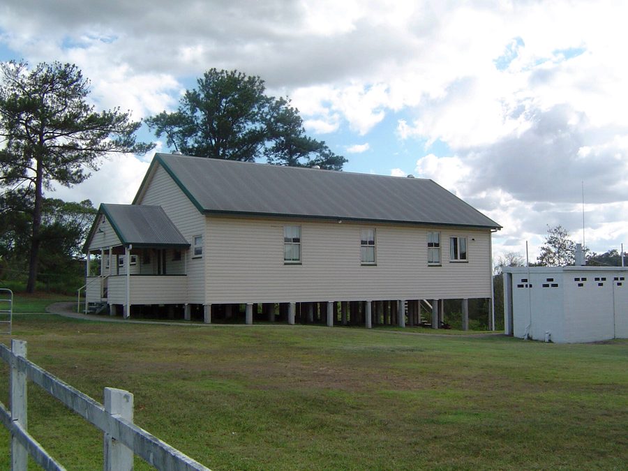
    Residents buy a former pineapple packing shed, which becomes Pullenvale Hall.

  5. 1961

    Moggill Pony Club is formed; it buys its O'Brien Road grounds in 1967.

  6. 1972

    Brisbane Independent School moves to Pullenvale on land donated by a local family.

  7. 1981

    Pullenvale State School moves to its new site on Grandview Road; the old school becomes the environmental education centre.

Before you offer

What to check before you buy in Pullenvale

Flood

Most of Pullenvale is hills, but Pullen Pullen Creek and its gullies run through the middle and south-west. On 20 November 2026, 66 of the suburb's 1,225 address points were inside Council's creek and waterway flood planning area, 36 inside the February 2022 flood extent and 12 inside the January 2011 extent, mostly on Grandview Road, Airlie Road, Lancing Street, O'Brien Road and Summerland Place. Another 45 were inside the overland flow overlay. On acreage the house can be high and dry while the driveway or the lower paddock floods, so pull the FloodWise Property Report for the lot and check the access road as well as the house.

Bushfire

This is the check that matters most in Pullenvale. Council's bushfire overlay covers about 36 per cent of the suburb's address points: 12 per cent in a high hazard area, 11 per cent in a high hazard buffer and the rest in medium hazard areas. The share is highest in the north and west below Mount Elphinstone and lowest around O'Brien Road. A lot in the overlay can mean building rules for a new house or an extension, ongoing work to manage vegetation, and a higher insurance premium. Check the overlay on City Plan, get an insurance quote early, and ask what vegetation clearing the zone allows.

Overlays and approvals

No character overlays, but most lots carry something: the rural residential or environmental management zone, bushfire, flood, waterway corridor or biodiversity overlays. These decide whether you can subdivide, where a pool, shed or second dwelling can go, and what vegetation can be cleared. Read the City Plan zone and overlay maps for the exact lot and look up past applications on the street.

Water, wastewater and internet

Acreage services vary lot by lot. Check whether the home is on town water, tanks or both, what the wastewater system is (septic or a treatment plant) and when it was last serviced, and what internet connection the street gets. Ask for the bore, tank and septic details in the contract, and get the building and pest inspector to look at sheds, retaining and driveways as well as the house.

Catchments

Most of the suburb goes to Pullenvale State School, but the eastern corner around Lisk Street, Herron Road, Woodfield Road and part of Pullenvale Road goes to Kenmore State School. Every home is in Kenmore State High's catchment. All three run enrolment management plans, so check the exact address on EdMap.

Red flags

  • A house in the high hazard bushfire area with no record of the vegetation or building work done to manage it
  • A driveway or creek crossing inside the flood extent, even when the house is above it
  • An old septic system with no service history, or no town water and undersized tanks

Where the value sits

  • A tired 1970s or 1980s home on a hectare, priced on the house rather than the land
  • A flat, usable lot in the O'Brien Road and Lancing Street pocket away from the creek, for horses or a family yard
  • Off-market acreage: sales here are few and often handled quietly, so being known to the local agents matters

Buying in Pullenvale: the questions we get

Which school catchment is Pullenvale in?

Most of the suburb, about six homes in seven, is in the Pullenvale State School catchment, and the eastern corner around Lisk Street, Herron Road, Woodfield Road and part of Pullenvale Road goes to Kenmore State School. For high school every home is in the Kenmore State High School catchment. Pullenvale Road and Herron Road are split, so check the exact address on EdMap and ask us which side of the line a house sits on.

Is Pullenvale a bushfire risk?

Parts of it. Council's bushfire overlay covers about a third of Pullenvale's homes, about one in eight in a high hazard area, mostly in the north and west below Mount Elphinstone. A lot in the overlay can mean building rules, vegetation management and a higher insurance premium. Check the overlay for the exact lot on City Plan and get an insurance quote before you commit.

Does Pullenvale flood?

The hills do not, but Pullen Pullen Creek and its gullies do. About 66 of the suburb's 1,225 address points are inside Council's creek flood planning area, mostly on Grandview Road, Airlie Road, Lancing Street, O'Brien Road and Summerland Place. On acreage the house may be well above the water while the driveway or lower paddock is not, so read the FloodWise report for the lot and check the access.

How big are the blocks in Pullenvale?

About a hectare is typical: the median freehold lot is about 10,100 square metres, and more than half are between one and two hectares. The smaller lots, about half a hectare, are near the Marketplace, and the biggest, often four hectares or more, are in the north and west.

What does $2.5 million buy in Pullenvale?

In 2026, a family home from the 1990s or later with a pool and a big shed on about a hectare, and in some cases a new build. One of our purchases here in 2026, a new four-bedroom home on about a hectare, settled at $2,560,000. Above $3m you are into renovated character homes and the view homes on the eastern ridge.

How do you get to the city from Pullenvale?

By car, along Moggill Road through Kenmore and Indooroopilly; the CBD is about 15 kilometres away in a straight line. Route 444 runs along Moggill Road on the eastern edge toward Indooroopilly and the city, but most homes are a drive from the stop, and there is no train line on this side of the western suburbs.

Tell us what you are looking for in Pullenvale.

A discovery call is thirty minutes on the phone, at no cost. What you are buying, where, and by when.

Book a discovery call
Photo credits

Photos: A Pullenvale acreage home, courtesy of Sacha Hennessy, Place West; Paddocks and gums at Upper Brookfield, next door, Kerry Raymond, CC BY 4.0; Paddocks at Pinjarra Hills, on the Pullenvale boundary, Shiftchange, CC0; Moggill Creek at Brookfield, Shiftchange, CC0; Gold Creek Reservoir through the trees, JulieMay54, CC BY-SA 4.0; A bush track in Anstead Bushland Reserve, on the Pullenvale boundary, Brisbane City Council, CC BY 2.0; The grassed dam wall and forest at Gold Creek Reservoir, John Robert McPherson, CC BY-SA 4.0; Pullenvale Marketplace on McCaskill Road, Kerry Raymond, CC BY 4.0; Pullenvale Hall on Grandview Road, Shiftchange, CC0; The arena at Brookfield Showground, John Robert McPherson, CC BY-SA 4.0; Gold Creek Reservoir at Brookfield, JulieMay54, CC BY-SA 4.0.